Stormwater quality data
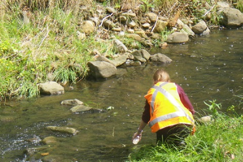
City of Hobart officers sample approximately 20 sites including the City's three main waterways (Hobart, New Town and Sandy Bay Rivulets) and other catchments six times a year as part of the monitoring program.
They are monitoring the waterways for:
- bacteria (E. coli and enterococci), as an indicator for faecal (sewer) contamination
- ammonia, as it can provide an easy and immediate indication of potential sewer contamination. Ammonia is also used in 'source tracking', to narrow down the location where a sewer spill is coming from. TasWater are contacted if there is any track of ammonia to repair the leak as soon as possible.
Monitoring program results
Officers have collected stormwater samples regularly since 2004.
2016 - present
| Site ID |
Catchment / rivulet |
Location & section (piped or open) |
GRADE: Good, Fair or Poor
|
CONTACT: Primary (P), Secondary (S) or Neither (N) |
| SW101 |
New Town |
OPEN - Alongside Albert Rd, near where it meets Risdon Rd |
POOR |
S |
| SW102 |
Maypole |
OPEN - 68 Risdon Rd driveway bridge |
POOR |
N |
| SW103 |
Providence gully |
OPEN - Foot bridge behind 45A Burnett St to Lefroy St carpark |
POOR |
N |
| SW104 |
Ashfield |
PIPED - Manhole in the Stanley St carpark, near the bowls club |
POOR |
N |
| SW105 |
Proctors Creek |
OPEN - University grounds near French St |
POOR |
S |
| SW106 |
University |
OPEN - Behind the UTAS Union building |
POOR |
S |
| SW107 |
Lambert |
OPEN - Lower end of Lambert Park, just upstream of piped section |
POOR |
N |
| SW108 |
Manning Rivulet |
PIPED - Manhole opposite 479 Sandy Bay Rd |
POOR |
N |
| SW109 |
Lipscombe |
OPEN - Behind 11 Plaister Crt |
POOR |
N |
| SW110 |
Wayne |
PIPED - Manhole at Sandown Village (3 Wayne Ave) |
POOR |
N |
| SW111 |
Folder |
OPEN - Behind 703A Sandy Bay Rd |
POOR |
S |
| SW112 |
Riverview |
OPEN - Backyard of 10 Mitah Cres |
POOR |
N |
| SW113 |
Cartwright |
OPEN - Embankment 20m upstream of pond above salt-water ingress |
POOR |
S |
| SW114 |
Wellington (Sandy Bay Rivulet) |
OPEN - Upstream of Quayle St bridge |
POOR |
N |
| SW115 |
Hobart Rivulet |
OPEN - Adjacent to the Hospital along Collins St |
POOR |
N |
| SW116 |
Wellington (Sandy Bay Rivulet) |
OPEN - 10 Waterworks Rd units, opposite to 38 Waterworks Rd |
POOR |
S |
| SW117 |
Hobart Rivulet |
OPEN - Tara St, below McRobies Rd outfall |
POOR |
S |
| SW118 |
New Town |
OPEN - John Turnbull Park, below Pottery Creek outfall |
POOR |
S |
This data will be updated every 6 months (after 3 sampling sessions): Data updated 19/06/2021
Download the full data table: Stormwater quality monitoring program results(PDF, 114KB)
Reading the results
Long-term analysis of these water samples is used to calculate two separate measures of water quality:
- The water quality grade for general recreation: Good, Fair or Bad.
- Using a 5-year 95th percentile which give each site a quality grade, based on the Recreational Water Quality Guidelines for Tasmania (under the Public Health Act 1997) These standards are currently accepted as the best measure of water quality (based on impacts on human health), and are used to dictate whether or not people should use water for recreational reasons.
- Recreational water quality classes: enterococci/ 100ml water: 0-200= Good, 200-500= fair, 500 = Poor.
- The level of contact the water is safe for: Primary Contact (whole body in the water: such as swimming or diving), only Secondary Contact (contacting the water but unlikely to swallow: such as wading), or neither.
- Using a 5- Year rolling median which provides an indication of 'base flow' conditions. These medians are used for the Australian and New Zealand Environment conservation council (ANZECC) contact standards for fresh water. These standards are not currently accepted as the best measures of water quality (based on impacts on human health), and are instead used as an informal indication.
- ANZECC Primary contact: 150 faecal coliforms (E.coli)/ 100ml water OR 35 enterococci/ 100ml
- ANZECC Secondary contact: 1000 faecal coliforms (E.coli)/ 100ml water OR 230 enterococci/ 100ml
Important notes
It is important to note that these results may be due to several factors other than consistently poor water quality:
- Any single spike in results will skew the 95th percentile result: while results may have been high in previous years, this may no longer be the case.
- We currently do not distinguish between wet and dry weather results. High rainfall flushes pollution through the stormwater system, so poor water quality is expected for several days after rain.
- The 5 year analysis is not based on enough samples to be accurate. Continued sampling will make the results more reliable over time.
Summary
While many of the sites are rated as suitable for Secondary Contact, none of the sites have a water quality class better than Poor, and so do not meet the Recreational Water Quality Guidelines for Tasmania.
All sites are currently classified as "poor quality". As such, we do not recommend contact with any waterways in Hobart at this stage.
Key information
Roles and realities of stormwater
When considering the poor recreational water quality of Hobart's waterways, it is important to remember that the waterways within our city as part of a system which directs stormwater into the River Derwent, as well as functioning as riparian and freshwater ecosystems. This means they have not been designed, maintained or sampled for recreation purposes when compared to other water bodies (such as the beaches indicated on Derwent Estuary Program (DEP) Beach Watch). It also means that all of the pollutants from roads, parks or any other hardened surface in the urban environment get washed into, and concentrated in, these waterways every time it rains.
Pathogens and health risks
Contact guidelines for recreational water quality help ensure the health and safety of people using the water. When water is contaminated by sewer leaks, it may also contain pathogenic micro-organisms. These organisms can enter your body by swallowing or inhaling, through the ears, nose or cuts in the skin when contacted directly. This can lead to infections and illness in the digestive system, lungs, eyes, nose, throat and the skin.