Sharing Bicentennial Park's track and trails
The City of Hobart is implementing a range of measures to improve the recreational trail network in Bicentennial Park. These measures are part of our commitment to creating tracks and trails that are accessible to a wide range of walkers, runners and riders.
The measures include changes to permitted track use relating to bikes and dogs, new signage to improve way-finding, formalising a shared use track and building a new shared use track.
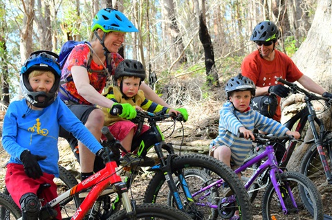
The changes will make bike riding in the area easier and safer, especially for families.
Under the changes, suitable parts of the Bicentennial Park track network will become shared use, similar to all of the tracks in Knocklofty Reserve.
Signal Station Track
Mt Nelson Signal Station to Enterprise Road will become shared use, allowing bike riders, runners and walkers to use it, as will Rialannah Track, which traverses Rialannah Road to Signal Station Track.
Lambert Rivulet Track
This track will become shared use, but riders will only be permitted to ride uphill.
Map of new shared use tracks
Send us your feedback
To send the City of Hobart feedback regarding your experience of changes to the tracks and trails in Bicentennial Park you can do so using our online feedback form.
Why have these changes been made?
The changes will improve family riding experiences in the park without detracting from existing uses. They will also ensure the entire community can get the most out of our recreational trail networks.
Up until now bike riders within the park have been restricted to fire trails, many of which are steep and gravelled, making riding difficult.
Riders, especially families, will now be able to embark on a short loop on flatter tracks from either the Mt Nelson Signal Station or the Enterprise Road entrance.
Giving riders uphill only access to Lambert Rivulet Track will open up commuting opportunities and give riders opportunities to enter the wider mountain bike network in the foothills of kunanyi/Mt Wellington.
These changes have been made in response to strong community feedback and assessed against Australian standards for shared use.
The changes are part of the City of Hobart's commitment to creating tracks and trails that are accessible to a wide range of riders, walkers and runners.
Sharing our tracks and trails
Many of the tracks found in Hobart's bushland reserves are shared use. This means they can be used for walking, bike riding and running.
Research and experience shows that shared use on suitably chosen tracks provides the greatest possible value to the community.
The City of Hobart encourages all visitors to respect each other by following the Track Users Code:
- give way to each other - walkers, riders, runners
- listen and look out for others
- keep left on wide trails.
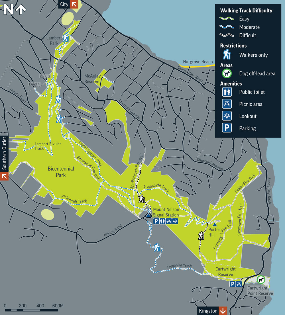
Bicentennial Park map(JPG, 223KB)